
AI News
03 Jul 2026
Read 9 min
AI whale detection systems for boaters How to avoid strikes
AI whale detection systems for boaters alert to likely whale locations so you can avoid vessel strikes
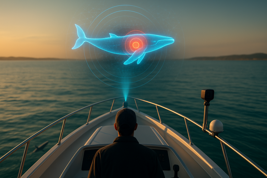
AI whale detection systems for boaters promise faster alerts and smarter routes that reduce the risk of hitting endangered whales. New tools pair onboard cameras and sensors with shared warnings, while university models predict hot spots using whale sounds and ocean data. Together, these upgrades help captains slow down, steer clear, and save lives.
Boating season is busy along the Jersey Shore, but North Atlantic right whales are in danger. Fewer than 400 remain, and vessel strikes are a leading cause of injury and death. The marine industry and researchers are rolling out new technology that helps boaters know where whales are now and where they could be next.
Onboard AI analyzes cameras and sensors to spot whales
Validated sightings trigger instant alerts to nearby boats
Vessels without sensors can still receive warnings
Industry leaders say the goal is simple: make it easy for every captain to slow down in the right place at the right time.
Whale calls picked up by underwater gliders
Ocean conditions like temperature and currents
Recent movement patterns of marine mammals
The output is a live probability map that shifts with the water. Captains can plan routes around higher-risk zones and choose safer times to transit. As researcher Ahmed Aziz Ezzat notes, the ocean changes hour by hour; these models update to match it.
Check whale advisories and voluntary speed zones before you depart
Keep a sharp lookout, especially near bait balls, birds diving, or slicks
Slow down in poor visibility or when whales are reported nearby
Give whales space; never chase, crowd, or cross their path
Report whales and collisions to authorities to improve data and alerts
As networks grow, expect more chartplotters and apps to display live whale alerts and forecast layers you can toggle on with your route.
Computer vision flags blows, backs, flukes, and surface ripples
Sensor fusion blends camera views with radar and GPS tracks
Confidence checks reduce false alarms before alerts go out
Gliders “listen” for whale calls and send data ashore
Models learn links between ocean features and whale presence
Maps update as conditions change, guiding safer timing and routes
This two-part approach—detect now, predict next—makes AI whale detection systems for boaters a strong fit for busy coasts where traffic and wildlife mix.
Shared protocols so all brands can send and receive whale warnings
Automatic reroute prompts when a risk zone lies ahead
More glider listening posts to fill gaps along migration paths
As these pieces connect, every sighting helps protect the next boat—and the next whale.
Strong boating culture and cutting-edge research are teaming up to prevent strikes before they happen. With AI whale detection systems for boaters, captains can make quick, informed choices: slow down sooner, steer clearer paths, and keep endangered whales safe. The more boats that join, the stronger the shield becomes.
(Source: https://www.nbcphiladelphia.com/news/local/new-ai-tools-aim-to-help-boaters-at-the-jersey-shore-avoid-endangered-whales/4423985/)
For more news: Click Here
How AI whale detection systems for boaters work
Smarter detection on the water
WAVS (the Whale and Vessel Safety Task Force) is building a system that uses AI to scan video, radar, and other sensors already found on many boats. When the system detects a whale, it can warn the captain right away and share that alert with nearby vessels, much like a traffic app flags a hazard ahead.Forecasts that move with the ocean
Rutgers University researchers built an AI model that predicts where whales are likely to be by combining:Why this matters now
Right whales are at a tipping point
North Atlantic right whales face a narrow path to survival. With such a small population, even a few strikes a year can undo gains from other protections. AI whale detection systems for boaters add a fast, flexible layer of safety that complements speed rules and lookout practices.From single boats to shared networks
The next leap is scale. WAVS and marine electronics partners are working on common standards so alerts can move between brands and platforms. Once a sighting is verified, it can reach every connected boat in range—no special hardware required. The task force aims to start deploying these tools by year’s end.What boaters can do today
Pair good seamanship with new tools
You do not need a full AI setup to cut risk right now. Use simple steps each trip and add technology as it becomes available.Inside the tech: detection and prediction
Onboard AI
Predictive mapping
What’s coming next
Standard alerts, wider coverage
FAQ
Q: What are AI whale detection systems for boaters and how do they work?
A: AI whale detection systems for boaters combine onboard cameras, radar, and other sensors with artificial intelligence to spot blows, backs, flukes, and surface ripples. When a sighting is validated the system can send instant alerts to nearby vessels, while separate predictive models create evolving probability maps showing where whales are likely to be.
Q: Who is building and testing these detection and prediction tools?
A: The Whale and Vessel Safety Task Force (WAVS) is developing an integrated system that links AI to sensors and navigation equipment, while researchers at Rutgers University have created predictive models using data from underwater gliders. Industry partners such as Viking Marine Group and Atlantic Marine Electronics are collaborating on standards and deployment, and these efforts are part of broader AI whale detection systems for boaters.
Q: How do shared alerts reach boats that don’t have detection hardware?
A: AI whale detection systems for boaters allow validated sightings detected on one vessel to be pushed out to nearby boats, much like navigation apps share road hazard warnings. This networked sharing lets vessels without detection hardware receive timely alerts to slow down or steer clear.
Q: What data do Rutgers’ predictive maps use to forecast whale hotspots?
A: Rutgers’ models combine whale calls detected by underwater gliders with ocean and environmental data such as temperature and currents, along with recent movement patterns of marine mammals. The output is an evolving probability map that shows the likelihood of encountering whales at a specific location and time, and these predictive maps are a component of AI whale detection systems for boaters.
Q: How should recreational boaters use these systems alongside traditional safety practices?
A: Boaters should pair good seamanship—checking whale advisories and voluntary speed zones, keeping a sharp lookout, and slowing in poor visibility—with technology as it becomes available. Using AI whale detection systems for boaters alongside these practices and reporting sightings helps improve situational awareness and the data feeding the network.
Q: What technical features help reduce false alarms in detection systems?
A: Onboard AI uses computer vision to flag blows and flukes and combines camera views with radar and GPS tracks through sensor fusion to improve accuracy. Confidence checks and validation steps are used before alerts are issued to other vessels in the AI whale detection systems for boaters network.
Q: When can mariners expect wider deployment of whale awareness tools and shared alerts?
A: The WAVS task force is working to standardize alerts and aims to deploy whale awareness tools and compatible alerts by the end of the year, with developers building shared protocols so different systems can communicate. Next steps include creating a network for passing notifications and expanding glider listening posts to fill coverage gaps.
Q: What challenges remain for implementing these systems on busy coasts like the Jersey Shore?
A: Challenges include the ocean’s rapidly changing conditions, gaps in sensor and listening coverage, and the need to validate detections to avoid false alarms. Ongoing work on shared standards, more glider posts, and broader adoption aims to address those limitations for AI whale detection systems for boaters.
Contents