AI News
16 Oct 2026
Read 10 min
How AI drones for public safety cut response times
AI drones for public safety speed emergency response, improving situational awareness and saving lives
Cities are shaving precious minutes off 911 responses with AI drones for public safety. These aircraft launch fast, find scenes quickly, and stream clear video to teams. Smart software plots routes, reads hazards, and guides units in real time, helping police, fire, and EMS act safer and faster.
Public safety leaders face a simple clock. Every minute counts. Drones, AI, and robotics now help agencies see the scene early, plan safe moves, and send the right resources. The tools are not just “nice to have.” They save time, reduce risk, and improve outcomes when people need help most. Below, see how agencies cut response times, what tech powers this shift, and how to start strong.
Rapid launch: Drone-in-a-box systems can lift off soon after a 911 call, while ground units roll.
Smart routing: AI maps the fastest, safest path and adapts to no-fly zones and weather.
Real-time intelligence: Live video with object and hazard cues reduces radio back-and-forth.
Pre-arrival guidance: Thermal views and labels show exits, victims, and risks before crews arrive.
Safer staging: Early aerial views help command set perimeters and entry points fast.
4K optical zoom to read plates, signs, and building features from a safe distance.
Thermal imaging to spot people in dark areas and see heat patterns in fires.
Computer vision to track subjects, count vehicles, and outline hazards on-screen.
LTE/5G links push steady video to dispatch, command, and units in the field.
Edge processors run AI on the drone for low-latency alerts and flight stability.
Cloud integrations feed footage into CAD, RMS, and evidence systems.
Autonomous launch, landing, and return-to-home reduce pilot load.
Obstacle avoidance and geofencing support safe flight in busy areas.
Docked “first responder” setups enable remote piloting within policy limits.
Priority confirmation: Verify if a call is active or already resolved.
Safer tactics: Spot weapons, aggressive dogs, or crowds before entry.
Traffic awareness: See closures and choose faster routes for ground units.
Thermal views reveal hidden fire spread and roof weakness.
Plume tracking shows wind-driven risk and smart evacuation paths.
Post-fire checks confirm hot spots, cutting overhaul time.
Wide-area grid scans with thermal to find heat signatures fast.
Loudspeaker guidance to direct lost hikers to safety.
Payload drops with water, radios, or first aid when ground access is slow.
Crash scene mapping clears roads sooner and reduces secondary collisions.
Storm and flood surveys show passable routes and stranded people.
Damage assessment speeds resource requests and public updates.
Training: Standardize pilot skills, AI use, and evidence handling.
Policy: Define approved missions, retention periods, and flight boundaries.
Privacy: Limit “always-on” recording, mask faces when required, and log access.
Community: Share flight maps, publish audits, and hold demos for residents.
Many agencies choose to prohibit face recognition and use strict auditing to protect civil liberties.
Time to scene: From 911 call to drone arrival.
Time to awareness: First clear view that changes tactics.
Officer and civilian safety: Fewer blind approaches and injuries.
Operational efficiency: Right-sizing response and reducing unnecessary rollouts.
Documentation quality: Faster crash mapping and cleaner case files.
Even small cuts in response time, paired with better situational awareness, can improve survival odds, reduce property loss, and lower overtime and fuel costs.
Define use cases: Pick a few high-impact calls, like DFR, traffic crashes, or missing persons.
Build a policy first: Set privacy, data, and safety rules before flying.
Pilot the program: Run a 90-day test, measure results, and refine workflows.
Train and certify: Create a repeatable training path for pilots and supervisors.
Integrate systems: Connect drones to CAD/911, command dashboards, and evidence portals.
Scale with docks: Add automated launch sites as results and trust grow.
Grants and careful budgeting help agencies adopt AI drones for public safety without straining local funds. Shared regional programs can also spread costs across departments.
Airspace and compliance: Align with aviation rules and coordinate with airports.
Weather and reliability: Set thresholds for wind, rain, and heat; maintain spares.
Data governance: Control who sees video, for how long, and for what purpose.
Change management: Train dispatchers and field units to use drone intel in real time.
Drones, AI, and ground robots are now everyday tools for many agencies because they give fast, clear answers when seconds matter. With good policy, training, and community engagement, teams can move sooner, act safer, and do more with less. AI drones for public safety are a practical, proven way to cut response times and improve outcomes for the people you serve.
(p(Source: https://www.yahoo.com/news/videos/ai-drones-robotics-becoming-everyday-131944053.html)
AI drones for public safety: Faster eyes in the sky
Why faster matters
Seconds can change outcomes in cardiac calls, fires, shootings, and missing-person cases. Drones get above traffic, reach hard places, and give a wide, stable view. With AI, they do more than fly. They detect hot spots, flag movement, outline perimeters, and share key data with officers and medics on the way.How drones shave minutes
The tech stack that speeds response
Sensors and vision
Connectivity and compute
Automation and safety
Where time savings show up
Drone as First Responder (DFR)
When cities deploy AI drones for public safety in a DFR model, a drone often gets to the scene first, confirms details, and gives command a live map. Crews then choose the best approach and the right number of units, which reduces both time and risk.Fire and hazmat
Search and rescue
Traffic and disaster response
Robotics beyond flight
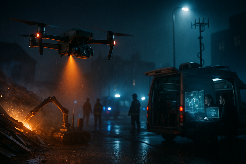
Ground robots extend the same gains. They enter tight or dangerous spaces, carry sensors into buildings, and relay video without risking people. In complex scenes, air and ground robots work together: drones map from above while small tracked robots inspect under vehicles or inside structures.Training, policy, and public trust
Good programs earn trust through clear rules and transparency.Measuring impact and ROI
Track simple, meaningful metrics:How agencies can start strong
Challenges to address early
For more news: Click Here
FAQ
Q: How do AI drones for public safety cut 911 response times?
A: AI drones for public safety launch quickly—often from drone-in-a-box systems—and reach scenes above traffic while ground units roll, streaming live video and AI-driven guidance that reduces radio back-and-forth. Smart routing, thermal views, and real-time hazard cues let command set perimeters and guide crews before arrival, shaving minutes from responses.
Q: What sensors and connectivity enable drones to deliver actionable intelligence?
A: Modern systems use 4K optical zoom, thermal imaging, and computer vision to read plates, spot people, track subjects, and outline hazards. LTE/5G links, edge processors for low-latency AI, and cloud integrations into CAD and evidence systems deliver steady video and automate alerts.
Q: What is the Drone as First Responder (DFR) model and why is it effective?
A: In a DFR model, AI drones for public safety often arrive first to confirm details, map the area, and stream live intelligence to command and units. That early situational awareness helps crews choose safer tactics and the right number of responders, reducing both time and risk.
Q: How do drones support fire, hazmat, and search-and-rescue operations?
A: Thermal imaging reveals hidden fire spread, roof weakness, and heat signatures for search grids, while plume tracking and post-fire checks inform evacuation and overhaul decisions. In search-and-rescue, wide-area thermal scans, loudspeaker guidance, and payload drops can find and aid people when ground access is slow.
Q: What policies and practices help build public trust in drone programs?
A: Agencies standardize training, define approved missions and data-retention rules, and limit “always-on” recording while masking faces when required and logging access. They also publish audits, share flight maps, hold community demos, and many agencies prohibit face recognition and use strict auditing to protect civil liberties.
Q: How should an agency start and scale a program using AI drones for public safety?
A: Start by defining a few high-impact use cases, build policy before flying, and run a short pilot—many programs use a 90-day test—to measure results and refine workflows. Train and certify pilots and supervisors, integrate drones with CAD/911 and evidence portals, and scale with automated docks while pursuing grants or regional partnerships to spread costs.
Q: What operational challenges must agencies address when deploying drones and ground robots?
A: Agencies must align with airspace and aviation rules, coordinate with airports, set weather and reliability thresholds, and maintain spare aircraft to ensure availability. They also need clear data governance to control who sees video and for how long, plus change management to train dispatchers and field units to use drone intel in real time.
Q: Which metrics should leaders track to measure the impact and ROI of drone programs?
A: Track time-to-scene and time-to-awareness as direct measures, along with officer and civilian safety, operational efficiency, and documentation quality for case work. Even small cuts in response time combined with better situational awareness can improve survival odds, reduce property loss, and lower overtime and fuel costs.
Contents